I took another ride with CFI Pete today to finish my high performance endorsement and G1000 checkout. For you non-pilots, additional training is required before a pilot can legally fly an airplane, as pilot in command, with an engine of more than 200 HP. Those airplanes are called high performance and the training is noted with an instructor's endorsement in the pilot's log book. One good thing is that the G1000 checkout will let me fly any of the G1000 172s at Bay Air in addition to the 182.
Pete and I flew out over the Gulf first, where I put the autopilot through it's paces. I had a few questions that the G1000 trainer software did not answer, silly things, like how to make it fly the GPS heading. Pete got me squared away on that and we headed back to Whitted for some landings.
Pete worked me hard. We did short field, soft field, no flaps and short approach (power off or simulated engine failure) landings. I was a lot more comfortable with the 182 today. It's bigger, faster and heavier on the controls, but in the end it flies pretty much like the trusty 172. The things to remember are: Don't let it get too slow, below 70 knots it's gonna sink like a rock. Don't land on the nose wheel. That big engine wants to pull the nose down, but keep it up and make the stall horn squeal before landing on the main gear. It's more complicated than a 172, so live by the checklist. Other than that, no problem.
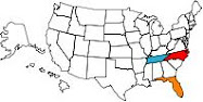
I don't know what's next. The wife and I will probably head out for breakfast one weekend, or a lunch run to Sharky's in Venice, mmmm that sounds good. We're going back to Cedar Key for an overnight stay, and I'm thinking about a stone crab run to Everglades City. One good thing about living in Florida is that there's lots of places to go.


I'm blameable like beer
3 months ago

